

PeaksCompass also supports new and developing walk leaders with practical, scenario‑based approaches to risk, group management, and decision‑making walks on the hill.
P.E.A.K.S gives a calm structure to think through the essentials — Personal state, Environment, Accompaniment, Knowledge of the route, and Safety & kit.
The PEAKS Framework

P– Personal State
How am I feeling? — physically, mentally, and in terms of focus — before I set off.

E – Environment
What the weather is doing now? What it might do later, and how the conditions shape the day.


Featured Episodes – What’s new
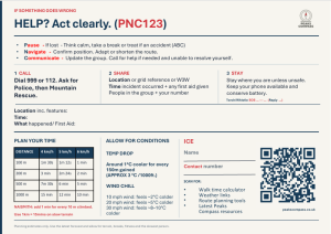
New November 26 – I have been meaning to complete this for ages, but here is my first iteration of a Handy Walkers Pocket Decision Guide. The printable A5 double-sided card designed to help walkers in decisions before and during a walk. Peaks Compass Tools – PeaksCompass
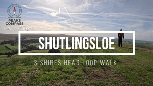
October 26 – Climb the sharp, distinctive summit of Shutlingsloe, locally loved as the Cheshire Matterhorn before the drop to Wildboarclough and on to discussing river crossing at the magical pools of Three Shires Head. (Click to watch)
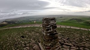
October 26 – One of the Peak District’s most iconic ridgelines: Mam Tor, the “Shivering Mountain”. Climb steadily to the summit, taking in Lose Hill, Back Tor and the exposed ridge that leads towards Hollins Cross.. Click to watch
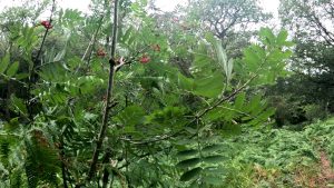
October 26 – New article (E)Trees – Rowan is a navigation clue, a tool wood, a wildlife marker, and a boundary tree. It’s not a “survival tree” in the dramatic sense, but it’s one of the most practically helpful trees in upland Britain — quietly guiding travellers, feeding wildlife, and offering small but meaningful resources to anyone who knows how to read it. https://www.peakscompass.co.uk/e-trees-rowan/
August 26 – New article (S) Hill jackets are your first line of defence on the hills — keeping you dry and protected when the weather turns. This page gives you a quick, reliable guide to choosing the right layer for safe and confident days out. https://www.peakscompass.co.uk/s-waterproof-jacket-layer/

Mountain Weather
Peak District mountain weather on Met OfficeWeather data provided by the Met Office and Windy.com . Used under their Terms & Conditions.

Peaks Compass Route Time Estimator
Estimate how long a route section may take using distance, ascent and walking pace.
Navigate smarter. Walk with confidence.
Based on a simplified version of Naismith’s Rule. Always allow extra time for weather, rough ground, navigation and rest stops.
About PeaksCompass
PeaksCompass uses scenario‑led walking to support thoughtful, confident decision‑making outdoors. Each video episode explores how small choices shape a safe, enjoyable day on the hills.
PeaksCompass™ is an independent walking project based in the Peak District.